
4037735104761

4037735104761
Description:
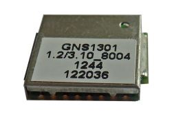
GPS/GLONASS GNS1301 UART,LOGGER
Supplier:
GNS
Matchcode:
GNS1301
Rutronik No.:
GPS1188
Unit Pack:
1500
MOQ:
1500
package:
SMD
Packaging:
REEL
Find Alternatives
Datasheet
- TTFF cold start
- 35 sec
- TTFF warm start
- 33 sec
- TTFF quickstart
- 1 sec
- Sens.tracking
- -165 dBm
- Sens.navigation
- -165 dBm
- Satellite sys.
- MULTI
- MEMS support
- N Y/N
- A-GPS
- Y Y/N
- Protocol
- NMEA/BINAR
- Antenna integr.
- NO
- Channels
- 33
- Oper.temp.
- -40/+85 °C
- Length
- 11,5 mm
- Width
- 13 mm
- Height
- 2,1 mm
- Weight
- 2 g
- HF sniffer
- N Y/N
- Automotive
- NO
- Package
- SMD
- RoHS Status
- RoHS-conform
- Packaging
- REEL
- Oper.voltage
- 3,3 V
- ECCN
- EAR99
- Customs Tariff No.
- 85269120000
- Country
- Germany
- ABC-Code
- A
- Supplier Lead time
- 11 weeks
The GNS1301B module utilizes the new generation MediaTek MT3333 GNSS chip that supports GPS and GLONASS and GALILEO simultaneously.
Due to its capability to use GLONASS and GPS and GALILEO at the same time, GNS1301B benefits from the higher availability of satellites in critical environments. The navigation performance and accuracy is further improved by using the correction data from SBAS (WAAS, EGNOS, GAGAN, MSAS), QZSS or DGPS(RTCM).